PRE-CHRISTMAS WET WEATHER WALK NEAR HADDON HALL
Deluge. That's the best word to describe the weather this morning. The roads are awash, the drains cannot cope and rivers are running down the white lines. It's going to be a wet walk.
We meet up in the Haddon Hall car park. The hall is closed and the car park is only supposed to be used for visitors to the hall, but there are some men selling Christmas trees from the car park and when PC asks (she's the first to arrive, as usual) they're happy enough to let us leave our cars there.
Admittedly, we're a little reluctant to leave the shelter of our cars and venture out into the storm, but this is our last walk before the festive season and it has to be a short one because daughter has a music exam later in the day, so we have to make the most of it.
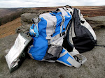
Naturally we layer up, all the waterproofs come out of the car and when we're dressed our rucksacks feel quite light. Mollie seems unperturbed by the weather and is happy enough to be out.
We trudge across the car park and go through a gate leading onto the uphill bridleway towards Conksbury and, ultimately, Youlgreave. The bridleway slopes gently uphill, but flowing swiftly downhill is a small river. It's hard to avoid the water so we splash our way through, but we do have to be careful as some of the underlying limestone is exposed and this is very slippery.
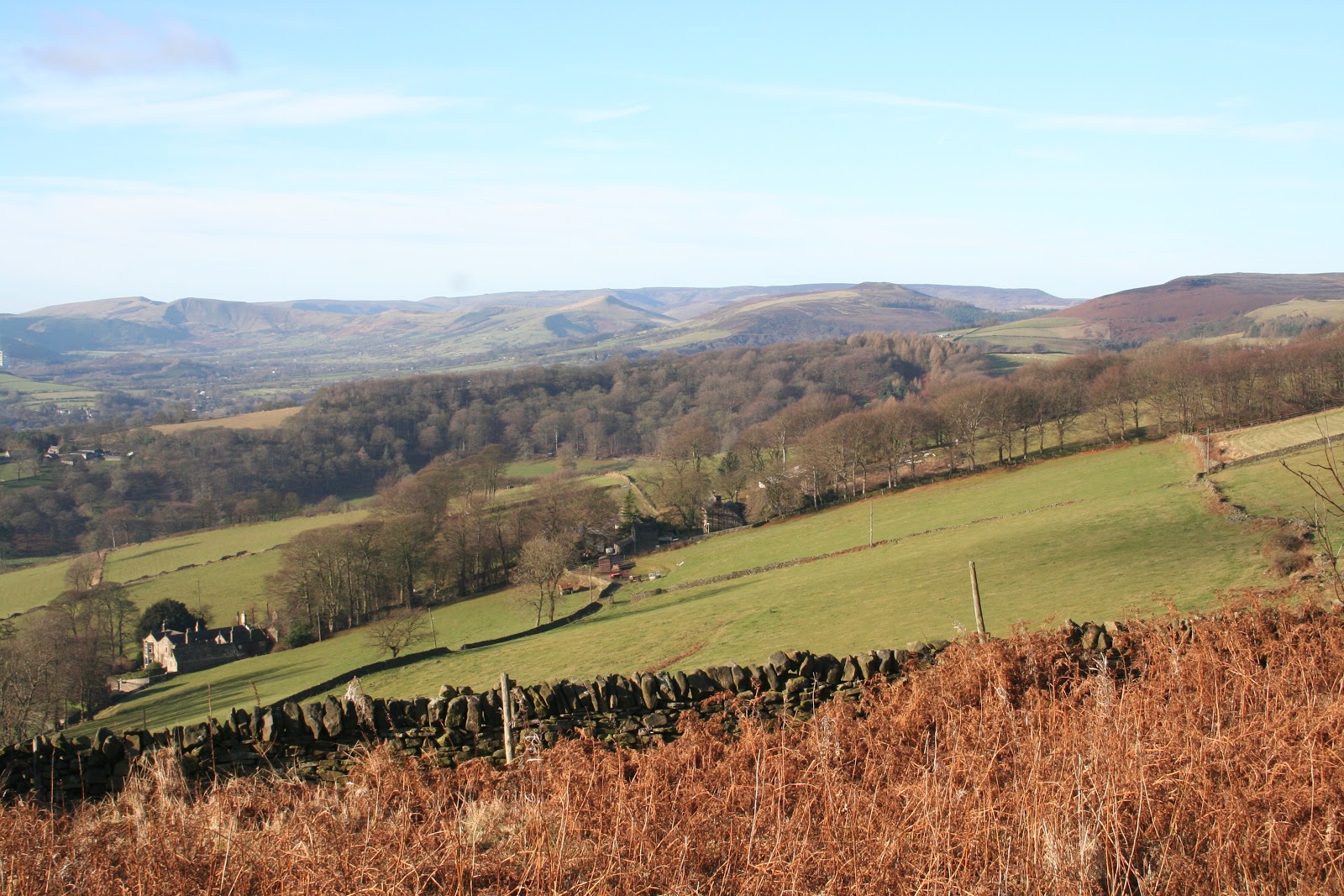
We pause a couple of times to look back at the view, Haddon Hall is peering above the tree line, but we wonder if the poor weather will make the photographs a washout.
With the driving rain we are tending to keep our heads down and our hoods up, so we aren't having much of an opportunity to look around. However, looking down at our feet sees us squelching through streams and mud-baths. At one point we're in a field with cows, but they are far off to our right and pose no threat, although an open gate to our left is an invitation for more cows to join them, so we pick up the pace a little.
Then it's a stubble field, thank goodness it isn't ploughed, and by the time we reach the top we've so much mud on our boots that it feels like a particularly sadistic kind of weight training for the legs.
We go through a gate, and PC does some interesting gymnastics with her walking poles as she tries to fasten the gate shut without paddling in a deep puddle. Pity I don't have the camera.
There are only sheep in the next fields, and the grass is well knit so at last we have something half-decent underfoot.
However, at the end of this stretch we reach the mud again where it is all extremely churned up next to a barn. We paddle through the mud to a gate and go through, pausing to consult the map and the finger-post. A few moments of puzzling and we return through the gate. We need to turn onto the track on the Haddon Hall side of the hedge.
Although the track is obviously well used by farm tractors it is, at least, relatively clear. Yes, there are some deep puddles, but these are easily avoided. At the far end is another gate out onto the small road leading from Conksbury to Bakewell.
We walk down the road, manage to avoid the flood in the dip in the bottom, then after passing Noton Farm Barn we take the right hand path down Intake Lane. At first this is just a path down the edge of a field, but it goes through another gate and turns into a proper lane with hedges on either side. It also has a lot of puddle and dips, and quite a bit of flooding.
But it is an easy track to follow so we don't have to think much as we bemoan the amount of work the Christmas preparations entail, and wonder why so many people buy so much food for just two days!
We decide not to take the right hand footpath leading through Burton Ashes Wood - it isn't clear on the ground and the ground looks very squishing and uninviting - so we walk down to the main road. We know Mollie won't like it but at least she has already had a decent run.
At the main A6 we turn right, pleased that there is a pavement to separate us from the heavy traffic thundering past. Naturally, Mollie isn't happy, but she is staying close.
We have to cross over to the other side of the road when the pavement swaps sides, then we decide to see if the footpath through part of Haddon Park is worth walking.
We turn left up the bridleway and cross the bridge over the swollen River Wye. On either side the fields have been turned into small lakes, complete with ducks, and the bridge itself is carrying its own pond. We reach the footpath turning at the side of the river but, as we suspected, a few yards along it the path disappears beneath the rising river. There is no point even attempting to go through so we back-track to the road to complete our journey.
It isn't long before the car park is in sight. The Christmas tree sellers have already packed up and gone home but the car park barrier is, thankfully, still open. We have a brief debate (we haven't eaten yet and our buns beckon) and we decide on driving to the Calton Lees car park at Chatsworth where we are able to change out of wet clothes and settle down for lunch.
We have a small toast from the secret flask - today it is a nip of Danzy Jones, a wonderful welsh whisky liqueur made by the Celtic Spirit Company, and the closest I have managed to find to the now unavailable scottish Wallace liqueur. PC gives it her approval, then pours out the coffees which we drink with our sandwiches.
The second coffee is shared with the buns - a festive treat of puff pastry fresh cream mince pies. Perfect.
Our day, and our walking year has ended too soon. Family festivities take over for a couple of weeks so we'll not be out again until the New Year when we will try to walk off the inevitable newly gained weight.
WE WISH A HAPPY CHRISTMAS AND A PEACEFUL NEW YEAR TO EVERYONE.
It's a grim morning; frosty, murky and cold. And we've both managed to be late. Quite an achievement even for us.
When we eventually manage to haul ourselves to the main Baslow car park it is very quiet. Clearly the prospect of a freezing cold walk has dimmed the enthusiasm of all but the hardiest of souls. First of all we consult the map as we're both a bit vague as to our planned route. With memories refreshed we decide that we'd be better parking nearer Bubnell since Mollie hates roads and starting from the centre of the village will mean having a fair walk on the main road. So, no sooner have we arrived than we're back in the cars again.
We drive down to West End where we turn onto the Bubnell road where we find somewhere to park next to the curb without obstructing any houses or the bus stop. Probably on a busy day this wouldn't be possible, or even fair on the locals, but there aren't many cars about today.
As soon as we're ready we head up the road for a few paces before stopping to look at the bridge. Baslow Bridge is a Grade 1 listed building (and a scheduled monument) dating mostly from the early 17th century (1608 is inscribed on one wall) and is easily missed by traffic thundering through Baslow on the A623.
We spot the footpath we need directly across the road from the bridge, and it's a good job we have a decent map as the path is narrow and the sign obscured by rampant ivy. We walk up the path and into a large field - the first of many - and as we climb gently uphill we keep pausing to admire the views; the village in the foreground, Baslow and Curbar Edges behind. To the north we can see the distinctive 'E R' letters where plants with contrasting foliage have been grown in huge rectangles. It seems these were planted in or around 2002, probably to commemorate the Queen's s golden jubilee.
The path is pretty direct and easy to follow even though it isn't particularly distinct on the ground, but it does have a couple of leg-stretching stone stiles and a very narrow crush.
Eventually the path veers gently to the left leading us down to Wheatlands Lane which is narrow and, in parts, icy. It dips and rises a bit and we're careful to avoid the slippy bits, and we get well out of the way when the odd car comes past.
As we pass Toost Wood we turn right over another stile next to a gate, then we cross a small rough field before going through a gate into a long, narrow wood. This is Bank Wood (South) and at last Mollie can go off the lead for a run and to terrorise some sticks.
There are some lovely views from here across to the Edges, although the village is lost in the dip. It feels colder in the wood, even though we are sheltered from the wind. At the far end of the wood we can see a clearing - and a bench. Lunch beckons!
As we enter the clearing we can see the huge 'cliffs' of a quarry - Back Dale Mine - not a particularly inspiring view but at least the bench faces away from it so we can enjoy views over farmland and what appears to be some very degraded ridge and furrow ploughing.
We have a nip from the secret flask first to warm us up, then a coffee to help a little more. Then we eat the sandwiches - never terribly inspiring - followed by double chocolate chip muffins (Co-op brand). These are seriously chocolaty, very rich with a good number of chocolate chunks on top for good measure. The cold has made them very hard, which I like, although PC would prefer to have them warmed up in the microwave! All we 'll need then is the cream (brandy cream for preference) and she'll be more than satisfied.
We finish off with more coffee then make haste to set off again. It really is too cold to hang around.
We leave the clearing and enter the northern part of Bank Wood, and again Mollie can run. Fortunately we have now lost sight of the quarry. Mollie chooses a branch of extreme proportions then tries to squeeze past us with it. Not a good idea!
The path turns right and goes through a gate in the wall then drops down to Bramley Lane, a minor road. Here we dog-leg slightly as we cross over to enter Bramley Wood, another linear wood but with a lighter, airier feel. As we near the end of the wood we come to a low, dark tunnel in the rhododendrons where the path cuts through them - it's actually rather nice and quite magical. We bet children must love it.
 Out at the other side and PC pauses to photograph frost covered bracken; it is more exposed here and more like moorland than woodland, although it is only a few paces before we're back into woods again.
We have a choice of right (back over the fields to Bramley Farm and Baslow) or left towards Calver. We choose the left hand path and are very quickly on a slippery, downward slope. The frost hasn't helped a great deal and we have to pick our way down with great care, but we manage it in one piece.
Out at the other side and PC pauses to photograph frost covered bracken; it is more exposed here and more like moorland than woodland, although it is only a few paces before we're back into woods again.
We have a choice of right (back over the fields to Bramley Farm and Baslow) or left towards Calver. We choose the left hand path and are very quickly on a slippery, downward slope. The frost hasn't helped a great deal and we have to pick our way down with great care, but we manage it in one piece.
It's stiles and fields again now, and as we dip down and climb up again heading towards the village our rambling conversation has turned to an 'O' level photography project we undertook whilst studying for our 'A' levels (many, many years ago) when we visited what was then Sheffield Polytechnic. We had to produce a couple of short films, and after we've reminded ourselves how awful our attempts were we sincerely hope that our endeavours were swiftly erased. Thank goodness there was no internet back then.
By now we're almost in the village and despite the multitude of paths we carry straight on to a dark and winding path with, thankfully, markers at every junction. We successfully negotiate all the twists and turns, continuing downhill all the time, then squeeze through another crush-stile into a very waterlogged field. As we do so the first tiny flakes of snow begin to fall. It isn't much, thank goodness, and it soon stops as we cross the iced-over boggy field, thankful for once for the sub-zero temperatures that have kept us free of the quagmire.
The path leads us down some stone steps and along a little lane to one of the larger roads through the village. This is another pretty village that, so far, has managed to stay off our radar.
We find a footpath to our right and follow it, hoping to reach the River Derwent, but we are thwarted when we come to the next field which has cows in it. And they are milling around in the gateway as the farmer tries to persuade them to do whatever it is he wants them to do. Given my aversion to all things bovine we hot-foot back down the path and back to the safety of the road which we follow until we reach the main A623.
Thankfully Mollie is tired now and isn't too troubled by the traffic, so we walk swiftly along to the bridge and go down the steep steps at the side of it which take us to the river path. The bridge has an underpass, but it seems very low, gloomy and claustrophobic.
The path follows the river through a field, and on the right is a large pond (courtesy of the recent heavy rain) which has frozen over and looks like an ice rink. As we leave the field we are suddenly confronted with our first bog where the land drains down to the river. We pick our way with extreme caution - PC's walking poles come in very handy - and we do an excellent balancing act on a fallen branch. Success. We aren't too muddy at all.
It's easy to follow the path now even though the river winds away to the left. It's a single straight line, though we do have another waterlogged field to contend with. Behind us, though, the clouds are gathering and it is hard to tell whether they are going to bring rain or snow. The air does feel very damp, so it could be either.
We press on, through the last field and onto the tarmac lane which takes us, eventually, down to Bubnell and Baslow.
It has been an interesting walk, but not one to do in very wet weather unless the ground is frozen. But today the weather has worked in our favour, and we have managed to avoid being snowed on (although overnight snow will cover the hills by morning), and the rain didn't start until we were in our cars and driving home.
It's two weeks to our next walk, then it will be a Christmas Break.
It's bitterly cold and icy but the clear skies mean it is a perfect walking day, although it is a bit tricky on some of the roads as the temperature has only just touched 0 degrees!
We meet in the car park in the middle of Hathersage. Although we've parked here before, and managed to walk through Hathersage on a couple of walks, this will be the first time we have chosen to actually centre our walk here.
First we debate on our route, something we didn't have time to plan in any detail last week, and once that minor issue is settled we try to decide how long we're going to take so we can feed the greedy parking machine. We opt for the maximum time - and maximum cost - as we don't want to rush. Then it's on with our gear, get Mollie out of the car and set off.
There is a path from the bottom of the car park leading through the grounds of the methodist church to the main road, which we cross over and turn right, skirting the post office before taking the small back lane up to join Baulk Lane.
Here we pause to check the map, it is always more confusing finding the right route in towns and villages with their tiny lanes and hidden corners. As we study the map another walker comes up to us and relates his 'near miss' on the black ice as he drove here, then he strides on his way.
Satisfied that we know exactly where we are we head off up Baulk Lane, turning right onto a footpath heading uphill towards the church. At the side of the gate leading to this path is a plaque stating Shuttleworth Memorial Path.
 We assume (but may be wrong) that it is in memory of the local squire, Captn James Shuttleworth, who, in 1784 opened the supposed grave of Little John (he of Robin Hood fame) and found a thigh bone 32" long. Whether the character of Little John is fact or fiction, it's a good story, and PC is keen to visit Little John's grave in the churchyard.
 We head up the path towards the church, enjoying some lovely views NW. The chuchyard is entered through a gate and we're surprised at how large it is, and how neat. We walk up towards the church and pause to look at the weathered gargoyles up above us. Then we turn right towards the famous grave. But before we get to it we are confronted by a parking meter! No, it isn't to make sure anyone who outstays their welcome is fined, but a novel collecting box to help with the upkeep of the church and yard. Just beyond the parking meter is the grave, yew trees at its head and foot, and impossibly long.
We retrace our steps to the church and continue through the churchyard, stopping at a tree with gnarled and twisted branches which must provide a haven for wildlife, then we step out of the churchyard to ponder our way again. Fortunately PC spots a footpath sign so we turn left and though a small gate into a field.
It's lucky that it is such a frosty morning or we'd be walking through a quagmire. The ground is rutted and covered with fallen leaves, but we can tell that it would be pretty grim underfoot if it wasn't so cold.
We walk uphill through the field, have another choice of paths, and decide to take the one on the tarmac road. It's a quiet lane, more of a long driveway to a farm, so we aren't likely to meet much - if any - traffic. It's a steady uphill climb and soon we're at another fork. So many decisions to make!
We head up the path towards the church, enjoying some lovely views NW. The chuchyard is entered through a gate and we're surprised at how large it is, and how neat. We walk up towards the church and pause to look at the weathered gargoyles up above us. Then we turn right towards the famous grave. But before we get to it we are confronted by a parking meter! No, it isn't to make sure anyone who outstays their welcome is fined, but a novel collecting box to help with the upkeep of the church and yard. Just beyond the parking meter is the grave, yew trees at its head and foot, and impossibly long.
We retrace our steps to the church and continue through the churchyard, stopping at a tree with gnarled and twisted branches which must provide a haven for wildlife, then we step out of the churchyard to ponder our way again. Fortunately PC spots a footpath sign so we turn left and though a small gate into a field.
It's lucky that it is such a frosty morning or we'd be walking through a quagmire. The ground is rutted and covered with fallen leaves, but we can tell that it would be pretty grim underfoot if it wasn't so cold.
We walk uphill through the field, have another choice of paths, and decide to take the one on the tarmac road. It's a quiet lane, more of a long driveway to a farm, so we aren't likely to meet much - if any - traffic. It's a steady uphill climb and soon we're at another fork. So many decisions to make!
We turn right, leaving the tarmac behind and entering what feels like an ancient lane, a hollow way between two high banks. It's muddy at the top, where we pause to admire the view, and as it continues uphill we walk on the right hand bank instead as the hollow path is tangled with brambles and saplings, clearly no longer used.
As the path brings us below Toothill Farm we struggle to find the way ahead.
From here it seems to be blocked, although there is a path to the right so we decide to follow that instead as it shouldn't take us too far out of our way. Again we have some spectacular views behind us: Abney, Mam Tor, Hathersage, the cement works!
We follow the path to where we can walk up to the access land behind Toothill Farm, going though a gap in the wall. Here we struggle through the dead bracken and brambles, keeping the wall on our left and sending Mollie on ahead, but she's more intent on finding interesting things to sniff.
Eventually we make it to the proper path and can just about tell where it goes down to the farm. From this side it can be seen, from the other - no chance. We pause for long enough to have a drink from the secret flask - well, we need warming up on a cold day like today - and the Ramblers Restorative goes down extremely well. I'd filled up the flask this morning and know that I only have one more refill left in the big bottle. Time to start making some more - PC will never forgive me if we run out.
Suitably lubricated we continue uphill on a clear path though the bracken which soon brings us out onto a rough track which will take us to the road. At the end of the track is a huge, flat stone boulder begging to be used as a seat, so we settle down for a while to enjoy a coffee and one of PC's homemade mince pies. Just enough to fuel our next leg of the journey.
We turn left up the road and keep to the verge, although Mollie isn't too keen on the traffic whizzing past. The views here are superb; Stanage Edge, Higger Tor, Hathersage Moor. And they are even better given that we have wonderful early-winter sunlight which adds a golden hue to everything.
At the top of the lane we turn left onto the lane running along Cattis-side Moor and beneath Stanage Edge. There are a few walkers up on the Edge today, but not as many as we would have expected.
We follow the road, do our own impromptu interpretation of Dancing on Ice when we discover that part of the road has turned into a skating rink, pause at the conveniently situated toilets, then head down to the car park to commandeer a picnic table for lunch.
The sun has started to dip, a few clouds have gathered and it has suddenly turned bitterly cold. Lunch is eaten quickly although the coffee warms us up. Buns for today are chocolate pecan cheesecakes - a new 'special' range from Morrisons - but they don't really live up to expectations. PC likes the thick biscuit base, I think it's too thick, but neither of us can taste a hint of pecan, although the chocolate is good. Perhaps we're getting too choosy!
We don't linger, so after leaving some biscuit crumbs for the birds we set off back, picking up the footpath behind the toilets which go sharply downhill. We pass a group of walkers straggling uphill as we negotiate the rubbly path which has enough water run-off running down it to turn it into a temporary stream.
At the bottom we go through a gate onto a smooth, green field path and stop for photos. Then we look around. Wow!
There is Stanage Edge, lit by the sun and framed by the trees. This view is sudden and startling, but if it was seen on the way up it would be slowly uncovered and the wow-factor would be lost. It serves to remind us though, that when out walking it is worth looking back every now and then.
We follow the grassy path gently downhill and come to North Lees Hall. It is the first time either of us have seen this lovely Elizabethan building, made famous in Charlotte Bronte's Jane Eyre as Thornfield Hall, and we spend some time admiring it. There is a lovely description of the property, along with historical notes at:
www.vivat-trust.org/properties.php?pid=
Yes, this is a site for renting the Hall (it is now a holiday let) but the site is very interesting.
We walk down the long drive from the Hall until we come to the road and turn right. We pass Bronte Cottage (doesn't look terribly Bronte-ish) then take the footpath across the road. It's level here, running at the side of the Hood Brook then skirting Brookfield Manor, and what could possibly be an old mill.
The path here narrows as it squeezes between a hedge and a fence, and in places it is completely submerged. At the far side we go though a narrow gate and into another long field.
The sun has well and truly lost its glow now and the breeze is feeling chillier. We cross the field and pass a group of houses on our left. Ahead is a coal lorry delivering to one of the houses, completely blocking the lane, but there is a small gate to one side so we are able to get past. We've reached the allotments now and it is only a short distance along Baulk Lane before we're back in the centre of Hathersage.
There are still plenty of people about but we swiftly cross the road and head up past the Methodist Chapel to the car park.
It has been an excellent day in an area that we really haven't covered before, but it has been well worth the effort. Although the temperature can't have been much above freezing all day it hasn't felt too bad with the benefit of sunshine and we're left wondering how much longer our luck will hold out!